• Home
  • News
  • Advocacy
    • Advocacy Issue Submission
    • Where we stand
    • Who are bikepackers?
    • U.S. Public Lands History
    • United States' wild lands at risk
    • Bikepacking Community Survey
    • Archive of submitted public comments
  • Routes
    • Our Routes
    • BPR Route Rating Scale
    • In development
    • Western Wildlands Route >
      • WWR Updates
      • WWR Downloads and Guides
      • WWR Segment 1
      • WWR Segment 2
      • WWR Segment 3
      • WWR Segment 4
      • WWR Segment 5
      • WWR Segment 6
      • WWR Segment 7
      • WWR Segment 8
      • WWR Segment 9
    • Bears Ears Loops >
      • Bears Ears Loops Downloads and Guides
      • Bears Ears Loops Updates
    • Plateau Passage >
      • Plateau Passage Segments
    • Colorado 14ers Loop
    • Craters and Cinder Cones
    • Orogenesis
    • Northwoods Route
    • Pony Express Route
  • Community
    • Bikepacking Community Survey
    • BIPOC Bike Adventure Grant >
      • BIPOC Bike Adventure Grant Application
    • Go Bikepacking! Teton Valley
  • Join/Give Today!
  • About
    • Mission
    • Who we are
    • Route Test Team
    • Partners
    • Contact
  • Store
  Bikepacking Roots

The Bears Ears Loops

Picture
General Overview of the Bears Ears Loops

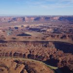
What are the Bears Ears? The Bears Ears are adjacent two buttes, together resembling a pair of bear ears, that rise from high on a plateau in southeastern Utah. Visible from many vantages for a hundred miles or more in most directions, these buttes have stood throughout human time and have deep cultural, historic, and political significance. We created the 700-mile Bears Ears Loops network to immerse bikepackers in this immense, complex, magnificent, and threatened landscape. The Bears Ears Loops, paired with our 100-page guidebook, will help riders better understand this landscape beyond its aesthetics and solitude. And a better understanding of a place during powerful experiences creates advocates for places like this.

The riding experience has been intentionally designed to not be particularly technical, to necessitate anything beyond traditional mountain bikes, or to only be accessible for particularly experienced bikepackers. And we have chosen to avoid increasing visitation to some of the most exceptional and seldom-visited areas of the Bears Ears National Monument region to avoid impacting their nature. We hope that you will enjoy your experience exploring the Bears Ears region, learning about its significance, and we ask that you help advocate with us for its future protection and conservation.


Picture
"Held in our Land, Held by our Ancestors" by Renee Hutchens

"We oftentimes hear phrases such as “land conservation” and “protecting public lands” in the outdoor industry which is heavily driven by preserving the ability to recreate in these places. We too advocate, but what drives our fight to protect our land is our belief that the land is us – our identity, culture, and way of life is held within Mother Earth. It is the same mindset you’d have if you were fighting for your own life or that of your loved ones."

-- Renee Hutchens, Diné mountain biker and conservation advocate on the importance of the Bears Ears landscape (quote from the foreword of the Bears Ears Loops Landscape and Route Guide)

On December 28, 2016, President Obama signed a proclamation that designated Bears Ears National Monument under executive power granted by the Antiquities Act. The new 1.35-million-acre Monument protected one of the most significant cultural areas in the United States, home to over 100,000 cultural and archaeological sites and sacred to many Indigenous groups. Not only did the designation of Bears Ears promise to protect the cultural and archaeological resources, but it marked the first time in history that a National Monument was created in response to the voices and advocacy of the Indigenous groups who call the landscape home.

Leaders from the Hopi Tribe, Navajo Nation, Ute Mountain Ute Tribe, Pueblo of Zuni, and Ute Indian Tribe formed the Bears Ears Intertribal Coalition in 2015 to represent a consortium of tribes unified in protecting and promoting the cultural, archeological, scientific, historical and natural resources of the Bears Ears region. The language of the Monument proclamation took a step toward building more inclusive land management practices by recognizing that Native Americans still use the land today and acknowledging that Native presence isn’t just a historical fact - it’s a present-day reality of the diversity of the United States.

On December 3, 2017, just 11 months after the designation of Bears Ears National Monument, newly-elected President Donald Trump revoked the
National Monument status of Bears Ears in an unprecedented executive action. Following a public review process that highlighted overwhelming public support for preserving Bears Ears National Monument, Trump allegedly exceeded authority granted to the President and reduced Bears Ears by 85%, an action currently being litigated.

Bikepacking Roots has been engaged in the Bears Ears issue since 2017, and the Bears Ears Loops are part of our continuing effort to raise awareness of what stands to be lost in Utah. The Bears Ears Loop proper meanders through more than 100 miles within the original boundaries of Bears Ears National Monument. By helping bikepackers experience this and the surrounding landscapes and understanding more about the cultural history and landscape through the accompanying 100-page Bears Ears Loops Landscape and Route Guide, we are creating new advocates for Bears Ears.

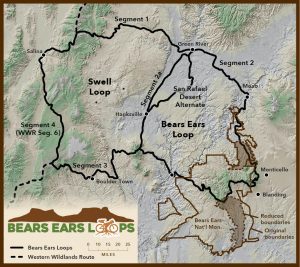
Click on individual segments in the map above for more detailed information; note that the waypoints included here are a small subset of the full ~400-waypoint dataset
Bears Ears Loops guidebook, downloads, and updates

To learn more about and download the most up-to-date  Bears Ears Loops GPS data, the 100-page guidebook, and the Bikepacking Guides mobile app, please visit the Bears Ears Loops resources page.

For any route updates, please refer to this page.

Segment-by-Segment descriptions of the Bears Ears Loops

Segment 1: Western Wildlands Route to Green River
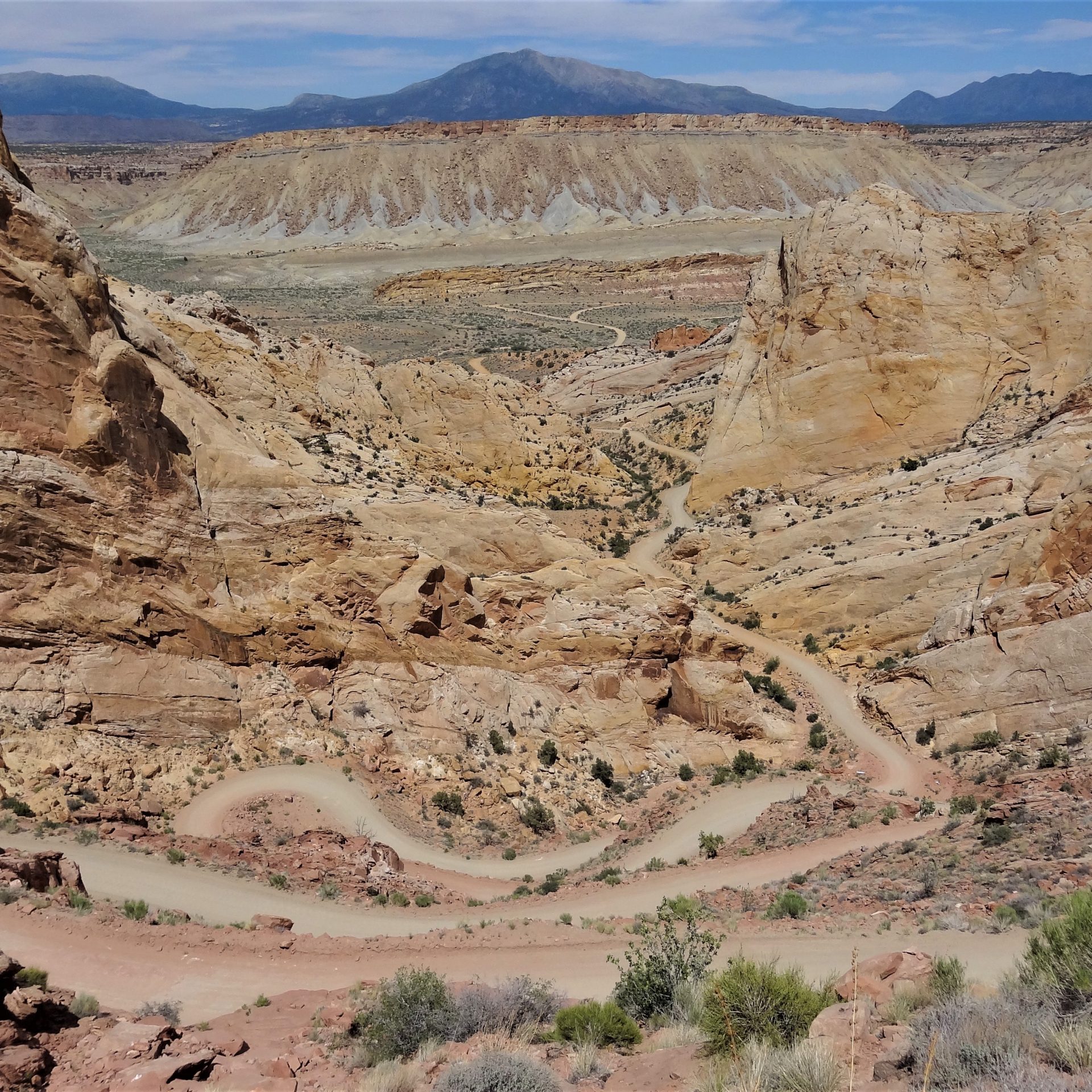
From above 10,000 feet in elevation on the high Wasatch Plateau to the Green River 6,000 feet below, Segment 1 emphasizes the topographic relief of the Colorado Plateau. In between those endpoints lies the ranching town of Castle Dale and the remote and shadeless periphery of the San Rafael Swell. The Swell is an upwarped region of bedrock that has been eroded into rugged castles, hogbacks, fins, and canyons that are visible from the route. Nearer to Green River, barren shale badlands become more dominant. The riding on this segment is mostly on bladed gravel and dirt roads with 20 miles of rougher 4x4 track on the east side of the San Rafael Swell toward Green River. Virtually all of this segment is impassible when wet.
Segment 2: Green River to the Henry Mountains via Moab and Bears Ears National Monument
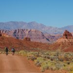
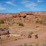
This segment is canonical Colorado Plateau riding at its finest - wide open high desert badlands, deep sandstone canyons, isolated mountain ranges, cliff bands that stretch as far as the eye can see, and so much more. After the quiet shale hill country between Green River and the bustling tourist hub of Moab, this segment crosses the original boundaries of Bears Ears National Monument and snakes its way above the Colorado River on the Lockhart Basin 4x4 road adjacent to Canyonlands National Park. Then the route climbs into aspen and spruce forests high in the Abajo Mountains before traversing southward to the scenic Elk Ridge. Still high above the desert, Elk Ridge offers refuge from the warmer temperatures below. At the southern end of Elk Ridge stand the revered Bears Ears Buttes, sentinels over the distant canyon country. Turning west, the route gradually descends amid redrock mesas and deep canyons toward the Colorado River bridge and the northernmost extent of Lake Powell at Hite. High above the towering sandstone cliffs are the Henry Mountains, the last mountains in the Lower 48 to be surveyed. A quiet paved climb amid slickrock walls leads to those mountains, and a rougher 4x4 track climbs to Wickieup Pass at just over 10,000 feet elevation at the crest of the range. Long stretches of this segment are impassible when wet, necessitating paying close attention to weather forecasts.

Segment 2a: Henry Mountains to Green River
This short segment connects the crest of the Henry Mountains north to Green River through the San Rafael Desert. After expansive views at Wikieup Pass, the route descends steadily from 9,000’ to nearly 4,000’ at the small ranching town of Hanksville on maintained dirt roads. North of Hanksville, riders can opt to stick to the quiet Highway 24 pavement along the eastern edge of the San Rafael Swell and among sand dunes and badlands to pass the warm low-elevation miles more quickly. However, the San Rafael Desert Alternate offers an off-pavement option to the east on bladed dirt roads that may be sandy and washboarded in places. The southern half of this segment and much of the San Rafael Desert Alternate are impassible when wet, necessitating paying close attention to weather forecasts.

Segment 3: Henry Mountains to the Western Wildlands Route
From the isolated peaks of the Henry Mountains to the sprawling Aquarius Plateau, this segment begins and ends at 10,000 feet. Near the eastern end of this segment at Bull Creek Pass, a short trail to the summit of Mount Ellen is well worth the side trip. Below the high peaks and plateaus lies the Burr Desert and Capitol Reef National Park where tilted layers of sandstone in the Waterpocket Fold create a nearly impenetrable barrier to travel. The Burr Trail switchbacks negotiate those sandstone hogbacks and provide access to the quirky rural community of Boulder Town. After the dry slopes of the Henry Mountains, the forested flanks of the Aquarius Plateau will feel downright lush, complete with flowing streams and small lakes. Long stretches of this segment are impassible when wet, necessitating paying close attention to weather forecasts.

Segment 4: Part of Western Wildlands Route Segment 4
Running congruently with part of Segment 6 of the Western Wildlands Route, Segment 4 traverses the western margin of the Colorado Plateau through Utah’s high plateau country. The climbs and descent are long, the views from up high are absolutely massive, and the geology dramatic. Elevations range from 5,000 feet in the lowest basins to well over 10,000 feet atop the highest plateaus. The northern end of the segment is on the Wasatch Plateau, following part of Skyline Drive, a 100-mile-long rugged and rough 4x4 road that traverses the length of the plateau. Heading southbound, the route plunges 5,500 feet down to the town of Salina before climbing more gradually along creeks and through higher sage-covered valleys to the scenic Fish Lake to the north. A descent leads to the small town of Loa before another 3,000 foot ascent takes riders back into the pines atop the sprawling Aquarius Plateau. Long stretches of this segment are impassible when wet, necessitating paying close attention to weather forecasts. Snow will likely persist into early summer on this segment, longer than any other parts of the Bears Ears Loops.

The Bears Ears Loops at a Glance

The Bears Ears Loops are broken down into segments that, when joined, comprise the Bears Ears Loop, Swell Loop, and Plateaus Loop. The following is a summary of the segments with their total mileages and elevation gain, followed by a list of possible segment combinations into various loops and Western Wildlands Route alternates with the respective mileage and elevation gain. All segments can be ridden in either direction. 

Bears Ears Loops segments overview
  • Segment 1: Western Wildlands Route to Green River – 110 miles / 3,000’ elevation gain
  • Segment 2: Green River to the Henry Mtn crest – 291 miles / 23,000’ elevation gain
  • Segment 2a: Henry Mtn Crest to Green River via Hanksville – 81 miles / 1,500’ elevation gain
  • Segment 2a - San Rafael Desert Alternate: 68 miles / 3,000’ elevation gain (20 miles longer than the main route, entirely dirt, and possibly sandy)
  • Segment 3: Henry Mtn Crest to the Western Wildlands Route – 117 miles / 12,000’ elevation gain
  • Segment 4 (part of Western Wildlands Route Segment 6): 128 miles / 9,000’ elevation gain

Loops & Western Wildlands Route Alternates

Bears Ears Loop 
  • Segments 2 + 2a
  • 372 miles / 24,000’ elevation gain
  • 5-9 days (~40-65 miles per day)
  • Average physical difficulty* (1-10): 6
  • Average technical difficulty* (1-10): 4-5

Swell Loop 
  • Segments 1 + 2a + 3 + 4
  • 437 miles / 26,000’ elevation gain
  • 5-10 days (~40-65 miles per day)
  • Average physical difficulty* (1-10): 6
  • Average technical difficulty* (1-10): 4-5

Plateaus Loop 
  • Segments 1 + 2 + 3 + 4
  • 647 miles / 47,000’ elevation gain
  • 9-14 days (~40-65 miles per day)
  • Average physical difficulty* (1-10): 6
  • Average technical difficulty* (1-10): 4-5

Bears Ears Western Wildlands Route Alternate
  • Segments 1 + 2 + 3
  • 519 miles / 38,000’ elevation gain
  • Adds 391 miles / 29,000’ elevation gain to the main Western Wildlands Route
  • 8-14 days (~40-65 miles per day)
  • Average physical difficulty* (1-10): 6
  • Average technical difficulty* (1-10): 4-5

Swell Western Wildlands Route Alternate

  • Segments 1 + 2a + 3
  • 309 miles / 17,000’ elevation gain
  • Adds 181 miles / 8,000’ elevation gain to the main Western Wildlands Route
  • 4-9 days (~40-65 miles per day)
  • Average physical difficulty* (1-10): 6
  • Average technical difficulty* (1-10): 4-5

* Click here to view the BPR route rating scale
Riding season considerations – snow and heat

Given the elevation range spanned by the Bears Ears Loops, choosing the time at which you decide to tackle a loop (or sections of it) requires careful consideration of several factors. Riding in southern Utah, unexpectedly to some, is characterized by continuous miles on high plateaus at elevations of 9,000 feet as well as across lower desert country. These high plateaus and the Abajo Mountains above Monticello remain snowy into May or June in most years, and snowstorms are likely to resume by sometime in late October or November. Subfreezing overnight lows are frequent into June and after September. Many of these plateaus also become unrideable when wet due to their clay-rich soil, so as thunderstorms become more frequent in July and August, pay careful attention to weather forecasts. Summer heat can also be oppressive in the shadeless miles of the eastern parts of the Bears Ears Loops. During summer months, daytime temperatures in the valleys routinely top 100 °F, but cloud buildup during monsoon season (mid-July to early September) moderates afternoon temperatures a bit.

So what is the ideal time of year for riders looking to pedal the entire Plateau Loop? Or what about just the Bears Ears Loop? It obviously depends on a rider’s pace, but generally, riders should plan on Segment 4 melting out between late May and mid June, and snow can be expected again by late October. The eastern parts of the Bears Ears Loops (Segments 1, 2, 2a, and 3) will be most enjoyable in late spring to early summer or early to mid fall. The Abajo Mountains above Monticello often will hold snow along the route until early May; riders may take the very rocky Plateau Passage option just west of Monticello to avoid snow up high, but expect some hike-a-bike. The Elk Ridge section of Segment 2, the high terrain south of the Abajo Mountains and northeast of Hite, often holds snow into April. The Henry Mountains farther west tend to receive much less snow and may be rideable even in late March. Mid-summer is likely to be oppressively hot but can be manageable.

 
For maps of current modeled snowpack depth, visit the Interactive Snow Information Map from NOAA’s National Operational Hydrological Remote Sensing Center (NOHRSC).

Frequently Asked Questions

  • What kind of bike should I ride? This route is designed with mountain bikes in mind, and it is recommended that riders have 2.2” or wider tires (with ample sealant) and low gearing sufficient for extended steep grades on a loaded bike. Tires wider than 2.5” are not necessary for any sections of the route (although the San Rafael Desert Alternate to Section 2a may have sandy sections on bladed roads). Long, steep, sustained descents (3,000 feet or more) will test brakes. Front suspension will be appreciated by many riders. Cyclocross and gravel bikes are absolutely not recommended for this route, nor are trailers. And with bike shops being few and far between in the region, carrying an appropriate assortment of tools and spare parts is mandatory.
  • Can I ride the loops in either direction? Yes, most certainly so. However, the route guide is generally written with clockwise riding in mind. 
  • What’s the ideal time of year to ride these loops? Given the elevation range spanned by the Bears Ears Loops, choosing the time at which you decide to tackle a loop (or sections of it) requires careful consideration of several factors. Riding in southern Utah, unexpectedly to some, is characterized by continuous miles on high plateaus at elevations of 9,000 feet as well as across lower desert country. These high plateaus and the Abajo Mountains above Monticello remain snowy into May or June in most years, and snowstorms are likely to resume by sometime in late October or November. Subfreezing overnight lows are frequent into June and after September. Many of these plateaus also become unrideable when wet due to their clay-rich soil, so as thunderstorms become more frequent in July and August, pay careful attention to weather forecasts. Summer heat can also be oppressive in the shadeless miles of the eastern parts of the Bears Ears Loops. During summer months, daytime temperatures in the valleys routinely top 100 °F, but cloud buildup during monsoon season (mid-July to early September) moderates afternoon temperatures a bit.
  • How long will the loops take to ride? Plan on roughly 40-65 miles per day. Don’t underestimate how rugged these routes are despite the generally non-technical nature of the riding.
  • Is there much water out there? No. One of the defining characteristics of this landscape is its extreme aridity. However, with proper planning and awareness, this can be safely navigated, and our route guide and waypoints indicate whether a particular water source is reliable, generally reliable, seasonal, or unreliable. A minimum water capacity of 6-8 liters is recommended, and more may be required if traveling in summer heat. All surface water should be filtered, boiled, or treated chemically. Carrying alum powder (available in the spice section of larger grocery stores) to help settle silt out of some water in this region can be helpful at times. A lightweight collapsible bucket helps with this settling process. But most water sources along the route are not particularly silty.
  • How far apart are resupplies and towns? Generally, resupply options are spaced 2 to 4 days apart depending on daily mileage.
  • What should I expect for weather? Riders should be prepared for sub- freezing overnight lows at higher altitudes during spring and fall and high temperatures of around 100°F at lower elevations during summer months. Generally, days in June and early July are clear and warm. From mid-July to mid-September, afternoon thunderstorms over higher terrain become more frequent. After mid-September, autumn sets in, and early season snow storms can impact higher elevations of the route. See the “Riding Season Considerations” section for more information.
  • How do I follow the route? The route is not marked on the ground in any way. We recommend that riders utilize the GPS data downloadable from the Bikepacking Roots website and a GPS such as the Garmin eTrex series. The GPS-enabled Western Wildlands Route mobile app from Bikepacking Guides will also include the Bears Ears Loops. If riders want to carry paper maps, the best option for a network of this size is to photocopy pages from the Utah state gazetteers from DeLorme or Benchmark. You can also piece together coverage of much of the network with the Latitude 40 maps and National Geographic Trails Illustrated maps. 
  • Is it easy to find places to camp? With 95% of the route on public lands, dispersed/wild camping is readily available along the vast majority of the route. Official designated dispersed sites and campgrounds exist in more popular areas. Around Moab, all camping along the route is limited to designated sites between roughly Hurrah Pass southwest of town and the regional airport northwest of town. Camping is also not permitted along the route in the short stretch through Capitol Reef National Park except at one small primative campground.
  • Are there many established campgrounds along the route? There are a few, but most are located in and around the bigger towns and more popular recreation destinations like National Parks and lakes/reservoirs. Potable water is often not available in established campgrounds on public lands in this region, and in the logistics information in this guide, water availability (potable, surface, or none) is mentioned for these campgrounds. Private campgrounds always offer potable water.
  • What do you mean by “impassable mud”? Long stretches of the route can become absolutely impassable when wet – a bike’s wheels will not spin once clogged with this clay-rich mud. Unimproved roads in this region are generally not negotiable during or immediately after wet weather. Pay close attention to weather forecasts and carry extra food in case waiting for a road to dry out becomes necessary.
  • Will there be bears? Or bugs? The higher elevation and forested parts of the Bears Ears Loops are in black bear territory. Mosquitoes and juniper gnats can be bothersome throughout the route (yes, there can be mosquitoes in the desert!), so we recommend bringing a headnet.
  • Do I need any special permits? No permits are needed for riding on these routes.
  • Why didn’t you include x road/area in these routes? There are infinite possibilities for creating routes and adventures through this region of the central Colorado Plateau. Our route choices include a broad range of considerations after extensive scouting of different potential options. Within the Bears Ears National Monument region, we have opted to keep the route on more commonly traveled roads rather than using some of the most secluded, seldom-visited options. That intentional choice is in an effort to not change the character of those quieter areas. We encourage individuals to explore those powerfully impactful areas, but we do not encourage publicizing routes through such places. 
  • Are you going to organize a race on any of the routes? We are not. Bikepacking Roots does not offer or endorse any competitive events.
Picture
Bikepacking Roots is the only non-profit organization dedicated to supporting and advancing bikepacking, growing a diverse bikepacking community, advocating for the conservation of the landscapes and public lands through which we ride, and creating professional routes. We value human-powered experiences and an inclusive, engaged, and informed membership (6,000 strong) that makes a positive impact as we adventure by bike.

Picture
Picture
Picture
Our Business Partners that support the bikepacking community, conservation, and public lands:
Our organizational partners that support bikepacking, advocacy, conservation, and outdoor recreation:


Bikepacking Roots is a 501(c)(3) non-profit charitable organization (EIN 81-2622394)

All content and route data copyright 2016-2021 Bikepacking Roots.
Bikepacking Roots and our logo are registered trademarks.

  • Home
  • News
  • Advocacy
    • Advocacy Issue Submission
    • Where we stand
    • Who are bikepackers?
    • U.S. Public Lands History
    • United States' wild lands at risk
    • Bikepacking Community Survey
    • Archive of submitted public comments
  • Routes
    • Our Routes
    • BPR Route Rating Scale
    • In development
    • Western Wildlands Route >
      • WWR Updates
      • WWR Downloads and Guides
      • WWR Segment 1
      • WWR Segment 2
      • WWR Segment 3
      • WWR Segment 4
      • WWR Segment 5
      • WWR Segment 6
      • WWR Segment 7
      • WWR Segment 8
      • WWR Segment 9
    • Bears Ears Loops >
      • Bears Ears Loops Downloads and Guides
      • Bears Ears Loops Updates
    • Plateau Passage >
      • Plateau Passage Segments
    • Colorado 14ers Loop
    • Craters and Cinder Cones
    • Orogenesis
    • Northwoods Route
    • Pony Express Route
  • Community
    • Bikepacking Community Survey
    • BIPOC Bike Adventure Grant >
      • BIPOC Bike Adventure Grant Application
    • Go Bikepacking! Teton Valley
  • Join/Give Today!
  • About
    • Mission
    • Who we are
    • Route Test Team
    • Partners
    • Contact
  • Store